Here, we present the four most popular approaches for a summer hike in the Okstindan mountains. For each we provide the distance to the nearest DNT cabin, as well as the estimated hiking time at a leisurely pace. All trails are signposted or way-marked with red T’s.
From INDERDALEN FARM in Brygfjelldalen (342 metres above sea level)
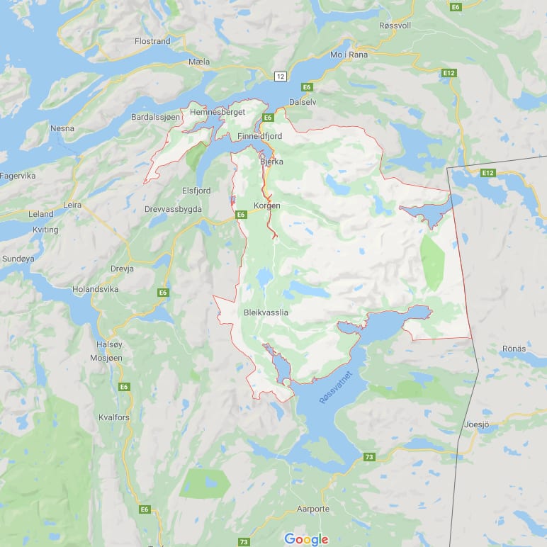
This farm is situated 12 km from Korgen village. Follow Fv806 towards Bleikvasslia. After about 6 km turn left onto local road Fv323, following it to the end of the road. The road is narrow but paved all the way. There is a large free parking lot with an information board.
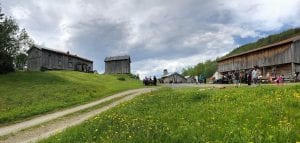
Inderdalen Farm has a service building with free toilets. Showers available (nok 75), soap and towel included. A farm shop and café are open sporadically. There is mobile phone reception near the farm.
Distances, elevations and hiking times
Inderdalen Farm – Gråfjellhytta cabin (1000 m.a.s.l.) – 7 km / 3 hours.
Inderdalen Farm – Rabothytta cabin (1200 m.a.s.l.) past Gråfjellhytta cabin (1000 m.a.s.l.) and Mørkbekken creek (680 m.a.s.l.) – 18 km / 8 hours.
Inderdalen Farm – Rabothytta cabin past Sjurfinnheimen – 11 km / 5 hours.
Inderdalen Farm – Rabothytta cabin past the glacier. (NB This unmarked route is suitable only for very experienced hikers!)
From LEIRBOTN / TIPPEN in Leirskarddalen (650 metres above sea level)
This trailhead is situated about 18 km from Korgen village. Drive Fv322, a narrow paved road, for 13 km. Then continue for 5 km on the steep and narrow construction road (closed in winter). At Tippen there is a large parking lot with an information board. Please note that the Fv322 road passes through several farms, where you must be cautious and drive slowly. Also note that there are no public toilets between Korgen village and Rabothytta cabin. Mobile phone reception is poor along the construction road.
Distances, elevations and hiking times
Leirbotn – Rabothytta cabin (1200 m.a.s.l.) – 5 km / 2 hours.
Leirbotn – Kjensvasshytta cabin (525 m.a.s.l.) – 10 km / 3 hours.
Leirbotn – Gråfjellhytta cabin (1000 m.a.s.l.) – 6 km / 3 hours (NB: This short route is difficult because it requires crossing a river. Hikers can opt for a longer route via Sjurfinnheimen.)
KJENSVATNET lake (525 metres above sea level)
The lakeside cabin Kjensvasshytta is situated 120 km from Korgen village. Follow highway E6 to the town of Mo i Rana, take highway E12 towards Sweden, and then turn left just after the tunnel at Umbukta cove. Continue for 40 km on the gravel road, which takes you all the way to the cabin.
Please note that the gravel road is closed during the winter, opening roughly around midsummer’s eve. There are numerous places to park along the road, allowing hikers to choose their starting point. Kjensvasshytta cabin has public toilets.
Distances, elevations and hiking times
Kjensvasshytta – In the summer, you can drive all the way to the cabin. Information board.
Kjensvasshytta – Gressvasshytta cabin – 4 km. You can drive to Gressvass dam and park there. Marked trail, 8 km / 3 hours. Alternatively you can use the parking lot where the road begins to climb Oksskolten and start your hike from there.
Kjensvasshytta – Rabothytta cabin (1200 m.a.s.l.) – 10 km / 4 hours. Parking is available at Kjensvasshytta.
Kjensvasshytta cabin – Oksskolten (1916 m.a.s.l.) – A 2.5 km drivable road takes you to the parking lot. Information board. The hike itself is 7 km / 8–10 hours round trip. NB. The trail from the glacier is unmarked, so an experienced guide and special glacier equipment are required! There is an alternate route around the glacier, but it requires crossing the Oksfjellelva river near Gressvasshytta, before following the signs to Oksskolten summit. Please check the map at Hemnes Trekking Association’s website.
SPJELTFJELLDALEN / GRANHEIM by Røssvatnet lake (390 metres above sea level)
This trailhead is situated 56 km from Korgen village. To reach it, drive Fv806 to Bleikvasslia and then turn left onto Fv324 towards Nymoen. There is a parking area to the west of the bridge. The road is paved all the way. Information board and accommodation available at Stekvasselv Farm, which is situated about 2 km before the parking spots near the bridge.
Distances, elevations and hiking times
Granheim – Gressvasshytta cabin – 18 km / 6 hours. Follow the Nordland Route (Nordlandsruta) through the Spjeltfjelldalen wilderness preserve.
Granheim – Kjensvasshytta cabin (525 m.a.s.l.) – 28 km / 10 hours. This follows the same route as to Gressvasshytta cabin.

